How to Get to Hoyo Azul Punta Cana: Location, Map, and Transport
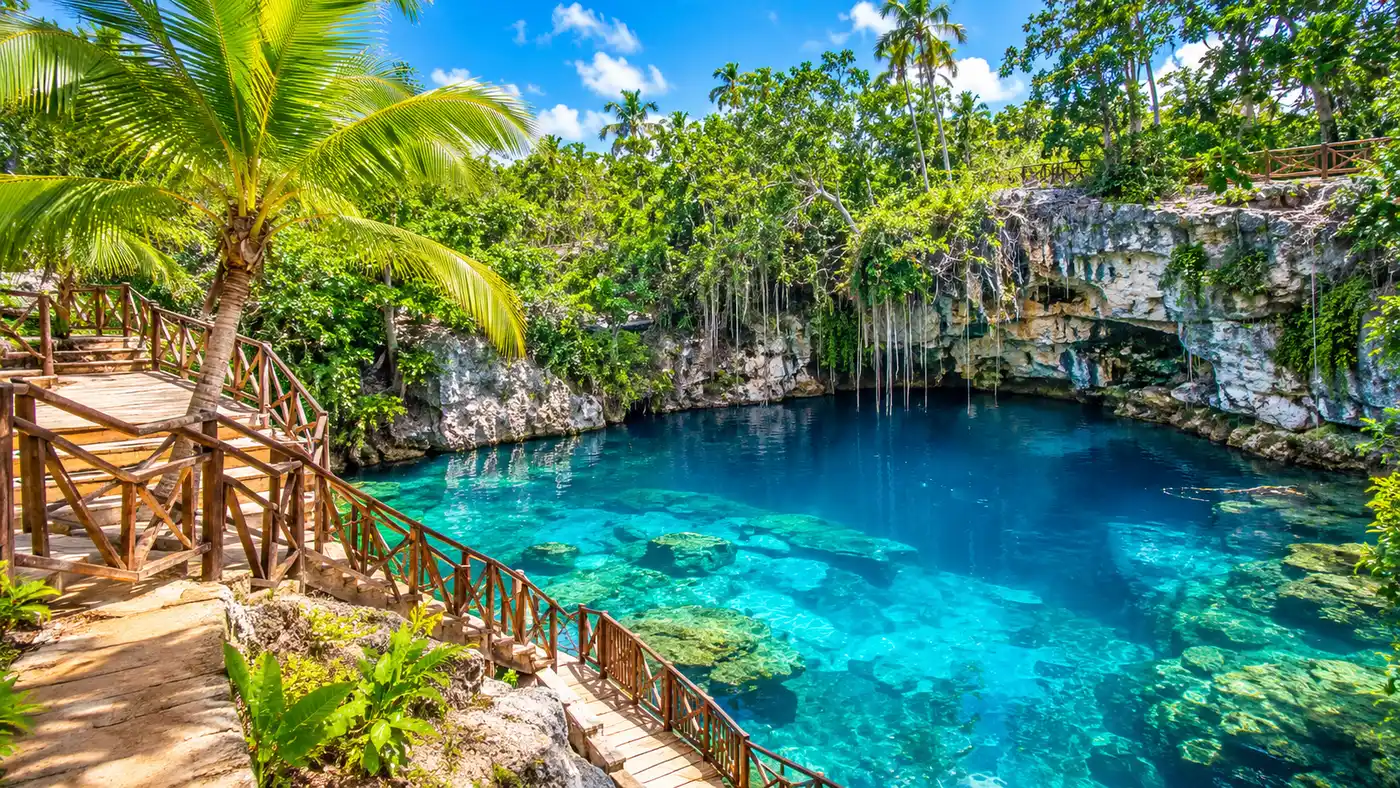
You step off the wooden deck and the water does not look real. It glows an intense turquoise, cold enough to make you catch your breath after walking through the humid Dominican brush. Finding the exact hoyo azul punta cana location can feel confusing if you rely solely on resort lobby brochures, mostly because promotional flyers talk about it as if it sits right on the beach. It does not.
The cenote hides inland against a massive limestone cliff face inside a private adventure property known as Scape Park. Getting there requires knowing which security gate to enter, how far your resort actually is, and whether booking an organized transfer makes more sense than negotiating with a local taxi driver. I made the trip twice recently, once in a rental sedan and once on a shared excursion bus. The difference in overall transit time and stress was noticeable. Here is the practical breakdown to help you map your route and arrive without unnecessary detours.
Book your hoyo azul punta cana experience:
Pinpointing the Hoyo Azul Punta Cana Location Inside Cap Cana
Geographically, the sinkhole sits at the far southern edge of the main Punta Cana hotel strip. It rests within the gated borders of Cap Cana, an expansive luxury enclave sprawling across roughly 30,000 acres of protected coastal scrub, marinas, and golf courses. When searching for the hoyo azul cap cana punta cana dominican republic coordinates on your phone, the marker pins right against the foot of El Farallon, a 250-foot sheer cliff made of ancient marine limestone that runs parallel to the coast.
You cannot just stroll up to this natural wonder from the roadside. The cenote is enclosed entirely inside the boundaries of Scape Park. Decades ago, local workers and cavers knew about the hidden pool, but today access is strictly controlled by park infrastructure. To reach the water, you must clear the main Cap Cana perimeter checkpoint, drive past the manicured roundabouts, enter the park facility, and follow a series of marked forest paths.
The landscape here looks completely different from the coconut palm groves surrounding Bavaro. Cap Cana is much drier. Thorny cacti, broadleaf evergreen shrubs, and jagged coral rock dominate the terrain. Because the cenote formed at the base of a vertical escarpment, rainwater filters down through layers of porous rock for miles before pooling in this natural depression, leaving the water startlingly clear and devoid of ocean silt.
How Far is Hoyo Azul from Punta Cana Resorts?
Travelers constantly ask how far is hoyo azul from punta cana, but the real answer hinges on which beach community your resort calls home. Punta Cana is not a single town. It is a 35-mile stretch of Atlantic and Caribbean shoreline divided into distinct hotel neighborhoods. Where you sleep determines whether your commute is a casual 15-minute hop or a tiring hour-long journey each way.
If you stay inside Cap Cana itself, properties like Secrets Cap Cana, Hyatt Ziva, or the Eden Roc are practically neighbors to the park. Your vehicle ride takes around 12 to 18 minutes depending on which secondary road you take past the marina. Punta Cana Village, near the international airport, sits roughly 20 minutes away via the main highway.
Head further north and the commute stretches out. Travelers staying along the dense resort row in Bavaro, Cortecito, or Arena Gorda face a 35 to 45-minute drive along Boulevard Turistico del Este. If you booked your stay in Uvero Alto at resorts like Excellence or Nickelodeon, you sit almost 38 miles north. That journey takes at least an hour each way, longer if you get stuck behind construction trucks or airport shuttles on the two-lane connectors.
| Hotel Zone | Distance to Park | Average Drive Time | Estimated One-Way Taxi |
|---|---|---|---|
| Cap Cana Resorts | 8 km (5 miles) | 12 - 18 minutes | $25 - $35 |
| Punta Cana Village / Airport Area | 15 km (9 miles) | 20 - 25 minutes | $35 - $40 |
| Cabeza de Toro | 27 km (17 miles) | 30 - 35 minutes | $45 - $55 |
| Bavaro & Cortecito | 34 km (21 miles) | 35 - 45 minutes | $55 - $70 |
| Uvero Alto | 61 km (38 miles) | 55 - 70 minutes | $85 - $100 |
Understanding the Hoyo Azul Punta Cana Map and Park Layout
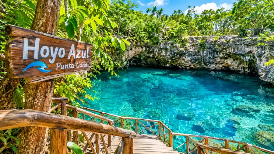
Once you arrive at the main parking area, the physical hoyo azul punta cana map changes from paved roads to pedestrian footpaths. You do not simply walk 20 paces from the entrance into the water. The walk from the ticket plaza to the cenote itself takes about 15 minutes at a steady pace, taking you deeper into the native forest.
The trail begins along a wide dirt track bordered by educational gardens displaying native orchids and medicinal herbs. Soon, the path transitions onto an elevated wooden suspension bridge swinging above a deep ravine. It sways gently underfoot. If you have active kids bouncing ahead, it bounces noticeably, but the steel cables and safety netting are sturdy. Looking over the railings gives you a clear look down into the dry limestone sinkhole formations that pepper this corner of the island.
Pro tip: Slip into proper water shoes with thick rubber outsoles before starting the hike; the wooden steps down inside the cliff cavern stay damp and slick throughout the day.
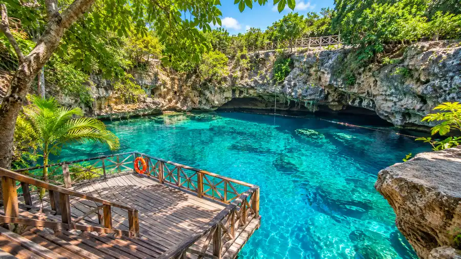
Past the bridge, the walkway wraps directly against the vertical limestone face of El Farallon. The heat of the open scrub drops away as shadows from the cliff wall shelter the trail. Wooden staircases guide you down into a cool, shaded pocket where the pool opens up before you. If you are curious about the geological quirks and water source of this sinkhole, you can read our guide covering Hoyo Azul depth and cenote facts for the full background.
Book your hoyo azul punta cana experience:
Transportation Options: Taxi, Shuttle, or Rental Car?
Reaching the park leaves you with three primary transit choices. Each option balances cost against personal schedule freedom in very different ways, and choosing wrong can easily add $100 to your day.
Grabbing a taxi hoyo azul punta cana directly from your resort lobby is by far the most expensive route. Dominican tourist taxis do not operate on digital meters. They run on fixed pricing tables managed by regional driver syndicates. A round-trip taxi from Bavaro can quickly climb past $120. You also need to coordinate a specific pickup hour with your driver, because empty taxis do not simply sit waiting outside the Scape Park gates late in the afternoon hoping for walk-up fares.
Most visitors skip the private cab and utilize the official Scape Park transfer buses. When you purchase admission tickets, round-trip coach pickup from major hotel lobbies is often bundled into the package or available for an extra $10 to $15 per person. The trade-off is time. You will stop at four or five other resorts along the coast to load passengers, adding an hour to your morning transit. You can see how transfer logistics fit into entry passes in our breakdown of Hoyo Azul tours and tickets.
Note: Standard Uber drivers frequently get turned away at the primary Cap Cana security gate unless the passenger has an official residential pass or registered booking voucher ready to display on a smartphone.
Renting a vehicle provides total independence. Highway 105 and the Coral Highway are smooth, multi-lane roads that rival interstate highways back home. If you want to spend the morning swimming in the cenote and the afternoon grabbing lunch at a quiet beach shack in Juanillo, driving yourself is unbeatable.
- Official park shuttle: most cost-effective for solo travelers and couples, picked up directly at your resort entrance on a fixed schedule.
- Private tourist taxi: best for large family groups wanting immediate departure, though expensive and requires locking down your return time in advance.
- Self-drive rental car: ideal for confident drivers wanting maximum freedom; parking at the park entrance is free and secure.
- Guided excursion van: organized by third-party tour agencies, combining transportation with an escort who navigates the park lines for you.
Practical Driving and Arrival Tips
If you choose to drive yourself, navigating the route is painless once you clear the initial highway exit. Coming south from Bavaro, stay on Boulevard Turistico del Este past the Punta Cana International Airport roundabout. The road name eventually transitions toward Highway 105. Watch for overhead green highway signs marking the Cap Cana exit on your right.
Taking this exit brings you directly to the primary Cap Cana security gatehouse. It looks like an upscale toll plaza flanked by stone pillars and palm trees. Slow down, roll down your front driver window, and tell the guard you are heading to Scape Park. They might ask to see your driver license or park confirmation email, hand you a temporary vehicle pass, and raise the barrier. Security guards here are professional, polite, and used to dealing with international tourists daily.
Once past the gate, your GPS might try to route you down private residential side streets that end at locked utility gates. Stay on the main paved dual-lane boulevard instead. Follow the clear wooden directional signs pointing toward Scape Park. The road curves through rugged natural bush for approximately 5 miles before ending at the park ticket building and asphalt parking lot.
- Security identification: bring a physical passport or high-resolution phone photo of your travel documents to show at the Cap Cana gate.
- Offline navigation: download the surrounding region in Google Maps or Waze beforehand, as cellular service drops to one bar near the cliff base.
- Arrival timing: aim to arrive at the parking gates by 8:45 AM; arriving before the large resort tour buses let you experience the water in near silence.
- No cash tolls: there are zero toll booths on the highway run between the Bavaro hotel corridor and the entrance to Cap Cana.
Leaving the property at the end of the day is just as simple. You follow the same main boulevard back toward the security gates. Hand the guard your vehicle pass on your way out, merge back onto the main highway heading north, and follow the overhead airport signs back to your resort district.
Frequently Asked Questions about hoyo azul punta cana location
Can you visit Hoyo Azul without entering Scape Park?
No. The cenote is situated entirely on private land managed by Scape Park. You cannot purchase a standalone trail pass or bypass the main park gates to swim in the pool without paying standard park admission.
Is there free vehicle parking at Hoyo Azul?
Yes. Scape Park has a paved, dedicated parking lot directly outside the main ticket pavilion. It is monitored by park security staff and does not cost anything extra for day visitors.
Can you take an Uber directly to the cenote entrance?
You can sometimes take an Uber into Cap Cana if your driver possesses local credentials, but getting an Uber to pick you up in the late afternoon for the ride home is notoriously difficult. Regular street cabs and shuttles are far more reliable for the return leg.
How long is the walk from the park entrance down to the water?
The hike along the nature path takes about 15 minutes each way. It covers roughly 800 meters across flat dirt trails, a suspension bridge, and several sets of wooden stairs leading down into the sinkhole.
Quick Reference
- Location: Inside Scape Park, Cap Cana enclave
- Distance from Airport: 9 miles (20 minutes)
- Distance from Bavaro: 21 miles (40 minutes)
- Access requirement: Valid park admission wristband
- Parking status: Free on-site paved parking
Book your hoyo azul punta cana experience:
Before You Go
Reaching this turquoise cavern is not hard, but it does require some advance planning rather than an impulsive afternoon stroll. Make sure you map your route past the Cap Cana gate, choose your transport method ahead of time, and aim to arrive right when the paths open in the morning. Getting there before the mid-day resort buses pull into the lot makes all the difference between sharing the cavern with fifty splashing tourists or floating alone in the quiet blue water.
Read more about hoyo azul punta cana.